Bridging the Gap Between Physical and Digital Spaces
Techniques such as Scan-to-BIM, LiDAR scanning, photogrammetry, and drone-based surveys are enabling teams to generate precise, data-rich assets that support decision-making across projects
.webp?t=1762957552)
195 Wellington St. Hamilton
In the Architecture and Design industry, new technologies are emerging constantly, each promising to make projects faster, smarter, and more efficient. During this rapid innovation, it can be challenging to determine which tools truly deliver value. One area gaining attention within the industry is digital reality capture and 3D modeling. These technologies help turn physical spaces into precise, data-rich digital assets. Beyond supporting design and construction, these technologies are increasingly helping companies plan, adapt, and respond to complex challenges.
As the built environment becomes increasingly complex, organizations are turning to digital solutions to bridge the gap between physical spaces and their virtual counterparts. High-accuracy reality capture and 3D modeling are becoming essential tools for smarter design, efficient construction, and informed asset management. Techniques such as Scan-to-BIM, LiDAR scanning, photogrammetry, and drone-based surveys are enabling teams to generate precise, data-rich assets that support decision-making across projects.
The Power of Scanning
Accurate digital representations of physical environments are no longer a convenience, they are essential for creating digital twins, advanced visualization tools, and reliable models for retrofit, design, and space planning. Terrestrial and mobile LiDAR scans, combined with detailed Revit models, can provide the level of detail necessary to inform project decisions, improve collaboration, and reduce expensive errors. For larger sites or infrastructure assets, aerial surveys connect physical and digital spaces by offering an efficient way to capture extensive datasets quickly, supporting both operational planning and long-term asset management.
As organizations across industries seek to maximize efficiency, reduce risk, and leverage data-driven insights, reality capture and 3D modeling are proving to be essential components of today’s project workflows. High-precision data enables teams to make confident decisions while minimizing delays and costly rework. Scalable capture solutions, from small interior spaces to large industrial sites or multi-location portfolios, allow organizations to maintain consistent, reliable data regardless of project size or complexity.
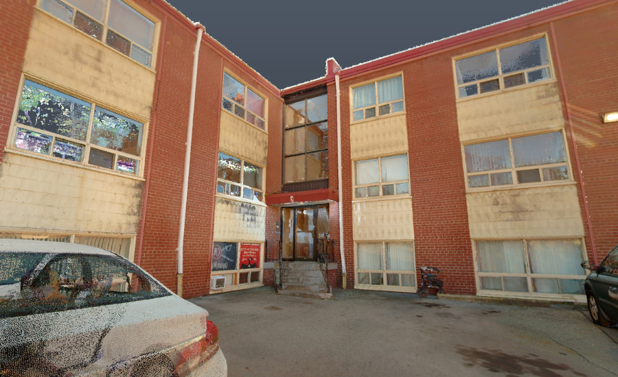
For example, our team completed the site scan for 195 Wellington Street in Hamilton in just a few hours, capturing detailed building elevation data that would have been difficult to measure manually. Through our Scan-to-BIM service, this data was converted into a Revit model and shared with the design teams. This allowed the client to efficiently move forward with the facility redesign while gaining access to a comprehensive virtual site walkthrough. As a result, redundant site visits were minimized, RFIs decreased, and overall project costs were reduced.
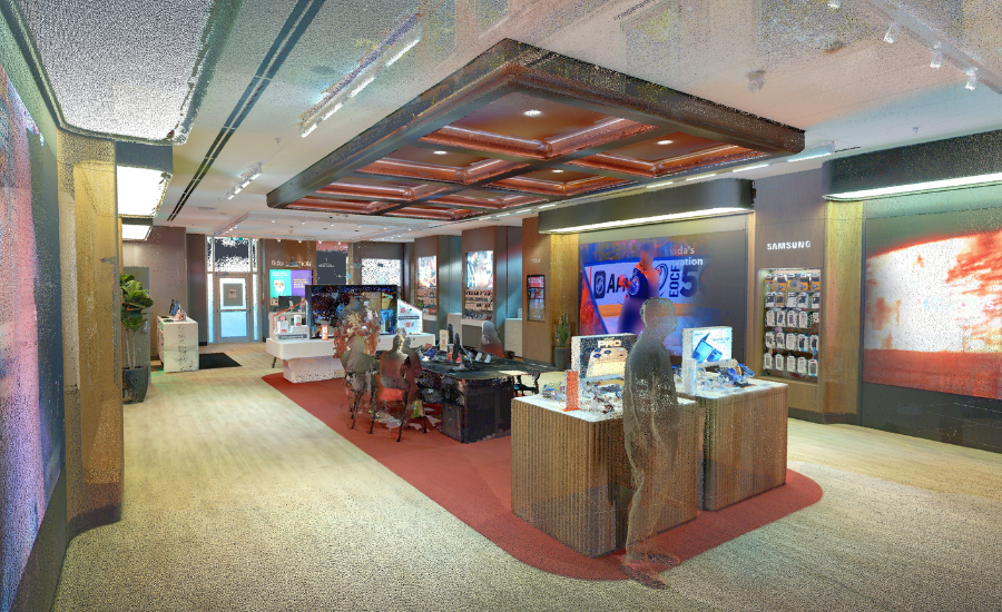
Arcadis scanned 12 Rogers-owned stores and kiosks, including Chatr and Fido locations, to support the development of accessibility reports and design recommendations. By leveraging scanning technology, the team accelerated the as-built documentation process and simplified field audit measurements. This approach allowed remote design teams to assess existing conditions, virtually tour each site, and prepare reports without multiple site visits. Overall, it improved the accuracy and speed of scan-to-BIM translation while reducing the costs and time typically required for repeat visits.
Drone and Thermal Advancements
Innovations in hardware, including terrestrial and mobile LiDAR scanners, drones with LiDAR and thermal imaging capabilities, and advanced processing software, are also expanding the possibilities for digital asset management. When applied effectively, these tools support design, retrofit, preservation, and long-term facility management, helping organizations plan strategically, streamline operations, and leverage data-driven insights to plan with confidence.
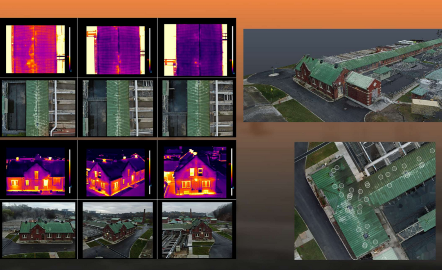 Photo courtesy of Arcadis
For example, a recent project from our team demonstrates the practical impact of reality capture on building resilience. The team conducted a thermographic drone survey for a Toronto Water Facility to investigate persistent roof water penetration issues. The resulting deliverables included a detailed thermographic report, a 3D point cloud, and a 2D orthomosaic, providing precise data to pinpoint areas of concern. This example showcases how advanced digital capture methods can extend beyond traditional design and construction use cases, helping organizations anticipate risks, make data-driven decisions, and strengthen long-term resilience.
By capturing accurate baseline scans of critical infrastructure, building envelopes, and drainage features, organizations can plan for resilience by giving designers and engineers precise models to assess vulnerabilities such as roof drainage slopes or façade integrity. Post-event recovery is also improved by comparing pre- and post-event scans to quantify damage, prioritize repairs, and support insurance claims. Additionally, these digital tools inform climate adaptation efforts by providing measurable data for retrofits, including flood protection, wind resistance, and waterproofing improvements.
Bridging the Gap
As projects grow more complex and the demand for data-driven decision-making increases, reality capture and 3D modeling are proving to be essential tools for the architecture and design industry. By providing accurate, scalable, and actionable insights, these technologies help our clients reduce risk, improve efficiency, and plan with confidence. Whether applied to routine design projects, large-scale infrastructure, or climate adaptation initiatives, digital capture is shaping how professionals understand and interact with the built environment by connecting physical and digital spaces.
Looking for a reprint of this article?
From high-res PDFs to custom plaques, order your copy today!
.webp?height=740&t=1767036885&width=auto "Header - BE 1170x658 (002).png")

.webp?height=740&t=1755781744&width=auto "KEE(2).png")
.webp?height=200&t=1775190767&width=200 "AIA")